The onset of the Ukraine-Russia conflict has brought attention to the strategic importance of commercial Synthetic-Aperture Radar (SAR) imagery for modern warfare.
While optical satellites fail to perform at night or when the sky is clouded, SAR technology can deliver reliable data at any time of the day irrespective of adverse weather conditions.
Besides supporting Ukraine’s military efforts, SAR images have been deployed by Western governments and media to fight Russian misinformation, substantiate allegations of war crimes, and support international sanctions against Putin.
Due to its wide-range of commercial and military applications, the deployment of SAR imaging has been booming in the last couple of decades, with the commercialisation of space seeing US-based SAR satellite operators dominating the global market.
On the other side of the ocean, the UK is at least three years away from developing its own constellation of SAR satellites and still lacks a sustainable acquisition model and trained workforce to support a competitive SAR ecosystem.
This begs the question: when, if ever, will the UK be ready to join the global SAR imaging market?
The role of commercial satellites in Ukraine
On February 24th, several hours before Vladimir Putin announced Russia’s “special military operations” in Ukraine, it was satellite images that led independent research analyst Jeffrey Lewis to realise that an invasion was about to take place.
The pictures, which showed Russian troops lining up along the Ukrainian border near Belgorod, had been taken by Capella Space, a commercial satellite startup based in San Francisco.
Ever since then, satellite images have been playing a key role in shaping the conflict.
The Biden Administration and Western media have been heavily reliant on rapid releases of third-party satellite imagery to shape the narrative of the conflict.
Besides contributing to fight Russian misinformation, satellite imagery has been directly supporting Ukrainian troops in their war efforts against the invasor.
The all-seeing gaze of satellites has been following military movements around the country, witnessing the shocking damage of Russian attacks on Ukrainian cities and, most tragically, images that are bound to support future investigations into potential war crimes.
This is not the first “satellite war”, as the Gulf War came to be labelled in the early 1990s, but warfare experts agree that the role of satellite imagery has changed dramatically in Ukraine.
Not only is the volume of satellite imagery greater but turnaround times are much faster than previous conflicts, such as Russia’s annexation of Crimea in 2014 or the Syrian war in 2011.
The private satellite industry has been growing dramatically ever since NATO declared space an operational domain in 2019, with governments throughout the world rushing to establish national Space Commands, define new space mission objectives and issue contracts with private partners to deliver on them.
Presently, national governments are no longer the only place to gain satellite imagery: the last few years have seen a great deal of satellite data collection outsourced to commercial firms.
While government and intelligence agency satellites collect secret data that require declassification to be shared with the public, private operators can quickly gather high precision data and share it online for as little as $10 (£7.60) per sq km.
The war in Ukraine is the apex of an ongoing trend that has seen satellite imagery grow in importance for several years.
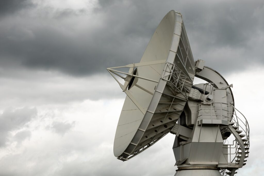
However, in this conflict one relatively new satellite technology has been deployed to an unprecedented scale, Synthetic Aperture Radar (SAR).
The rise of SAR Images in Modern Warfare
While traditional optical imagery relies on visible or infrared light, SAR technology beams microwaves that can pierce through clouds, reflecting off any target on Earth and bouncing back up to satellite detectors irrespective of day time.
Besides seeing at night and through cloudy skies, SAR satellites can provide near real-time assessments of battleground developments, while optical data tends to be outdated by more than 72 hours.
Considering that in spring Ukrainian skies are heavily clouded and most enemy activities take place at night, on March 1 Ukraine’s Vice Prime Minister Mykhailo Fedorov called on a number of Western satellite operators to share live SAR data.
According to EOS Data Analytics, which has been handling data collection on behalf of the Ukrainian government, SAR imagery has been providing the army and resistant forces with “situational awareness and relevant intelligence regarding enemy troops and equipment activities (especially refuelling operations)”.
Ukraine’s appeal is a reminder of the growing importance of SAR imagery for modern warfare and provides us with a fairly accurate snapshot of the global SAR imaging market.
Out of the eight commercial satellite companies that were urged to share SAR data, four are from the USA (Capella, ICEYE; iQPS; Umbra), while the remaining four are from the EU (Airbus, Spacety; COSMO SKyMed, Sar-Lupe).
Not a single British company featured in Ukraine’s appeal, and understandably so: as of 2022, there is no such thing as a UK-based SAR satellite operator.
The Global SAR Imaging Market: a US-UK Comparison
The global SAR market was valued at $3.4bn (£2.73bn) in 2021 and is estimated to hit an impressive $6.64bn (£5.32bn) by 2027, at a CAGR of 11.20% in the next five years.
North America has been dominating the market, having secured nearly a third of its value in 2019.
This has to do with the high number of SAR manufacturers that are based in the US and with the dramatic rise of military spending into data acquisition.
The game changer took place in 2020, when the US government lifted federal regulations that had been keeping private companies from creating their own SAR systems.
As the US realised that limiting national SAR capabilities would not automatically prevent its adversaries from accessing data, the Commerce Department issued a rule codifying licensing reforms.
This has allowed US commercial firms to sell higher resolution data above 0.25m for military and commercial purposes alike.
Outside the military-industrial complex, SAR is now commonly used to measure sea ice levels, detect oil spills, evaluate collapsed mines, make flood maps, monitor glacier variations, check out wind patterns, watch erosion, cultivate knowledge of vegetation, predict landslides and keep an eye on volcanic activity.
The conflict in Ukraine accelerated growth, with the US National Geospatial-Intelligence Agency recently announcing that it would be doubling the purchases of satellite imagery from private operators.
This adds up to the contracts that the US defence and intelligence already had in place with private SAR satellite operators like Maxar Technologies, Planet Labs, and BlackSky.
Some of these companies have been playing a key role in Ukraine, gathering and analysing data from the battlefront for several months now.
From the very beginning of the conflict, Maxar was busy monitoring the build-up of Russian military forces along the Ukrainian border, while BlackSky provided Western media with images of one of the first engagements of the conflict – the attack on the Luhansk Thermal Power Station on February 23rd.
While the US dominates the global SAR imaging market, the situation in the UK remains difficult.
Historically, the UK has never had its own SAR satellite system, with the military and national security establishment reliant on allies such as the United States and private companies like Airbus.
Things might be changing relatively soon, as the UK is planning to have its own constellation of SAR satellites in orbit by 2025, Project Oberon.
This is surely good news, as the Oberon system will provide UK Defence with the ability to conduct intelligence, surveillance and reconnaissance operations in full autonomy.
This is surely good news but the question must be raised: is the UK’s space industry mature enough to sustain its very own SAR imaging market?
Last January, the Government released the Space Defence Strategy, which outlines future plans to increase the UK’s share in the global space economy from 5.1% in 2018/19 to 10% by 2030.
The document mentions plans to augment “acquisition” several times and stresses the importance of improving intelligence product integration processes.
But when it comes to the timeline, the document is, to say the least, vague, with phrases like “we will” forcing industry experts to raise long-overdue questions.
First things first: by the time the Oberon constellation is up and running, will there be enough investment in the digital architecture to support SAR data processing and sharing?
Just to give you an idea of the magnitude of the problem, the US National Reconnaissance Office has recently closed contracts with Maxar, BlackSky and Planet to provide satellite imagery to defense and federal civil agencies for the next ten years.
While these three contracts are worth more than £3bn, the UK Defence’s entire space budget over the same ten-year period is £6.4 billion.
Admitting that the UK will change its acquisition model and pump enough investment into a national SAR ecosystem, how and where exactly will we get the trained workforce to deliver on this?
In 2019/2020, 47,000 people were employed in the UK space industry, or 0.14% of the total workforce.
Considering that the US space industry employs 2 million people (1.4% of all employment), this is not nearly enough to support the ambitions outlined in the Space Defence Strategy.
Promises of launching a Space Academy are somewhat encouraging.
Otherwise, it is difficult to see how exactly the UK will manage to gain the expertise to compete in the global SAR imaging market.
About JP Aero
We supply a wide range of space industry fasteners. Whether standard, metric or custom design we are leading UK experts.
We are AS9120 REV A & ISO9001:2008 approved and SC21 compliant.
Over the years we have built up a broad depth of knowledge around all types of fasteners in commercial aviation, heavy industry, oil & gas exploration, defence and now the space industry.
Our long-standing commitment to quality and service means that we work with some of the biggest organisations within the space industry, and we are available to share that expertise in our field with you.
To find out more about procuring small satellite fasters contact our team today and we will be happy to help in any way we can.